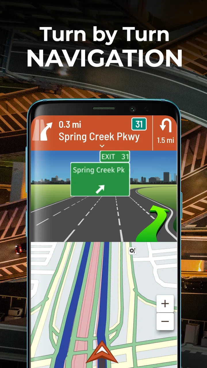
Hammer: Truck GPS & Maps
- 4.6
- Rating
- 1.00M
- Installs
- Free
- Price

 Analysis by App-foxy
Driving a commercial truck is not simply a longer version of driving a car. A route that looks fine on a normal map can become awkward or unsafe when height, weight, fuel stops, parking, and weigh stations enter the picture. That is the problem Hammer: Truck GPS & Maps tries to solve, and after spending time with it, I found its most useful quality to be its focus. It is not trying to be everything for everyone; it is built around the practical decisions that matter behind the wheel of a truck.
Developed by TruckersReport.com, this free navigation app sits in the Maps & Navigation category and is aimed primarily at commercial drivers. Its store summary points to truck-focused routing, parking, speed-limit information, diesel fuel, and weigh-station alerts. Those details are more important than they may sound. For a professional driver, arriving at the wrong entrance, missing a suitable parking opportunity, or discovering a restriction too late can cost much more than a few extra minutes.
I also understand why the app has attracted a large audience: it has passed one million installs and holds a 4.7 average from roughly 65 thousand ratings. Those figures suggest that many drivers find the truck-specific approach useful, but they should not replace your own testing. Navigation is highly dependent on your vehicle, routes, signal conditions, and driving habits.
You May Also Like

 Blood Strike: 2.5 Anniversary
Blood Strike’s Loadouts Turn Every Drop Into a Tactical Gamble
A close look at Blood Strike’s custom loadouts: how fast access to signature weapons reshapes its battle royale rhythm, rewards preparation, and narrows the gap between fights.

 Pandora - Music & Podcasts
Pandora’s Music Is Easy to Start, but Harder to Recover
Pandora’s strength is its low-effort path from a seed to a station. Its weak spot is how much confidence it asks you to place in connection, setup, and quiet recovery.

 8 Ball Pool
 Is Built on Rivalries, Rematches, and Routine
A close look at the rivalries, rematches, shared routines, and unanswered safety questions that turn a quick pool match into a persistent mobile community.

 Samsung Music
’s Quiet Strength Is Playing What You Already Own
Its reach comes less from spectacle than from dependable access to a personal library. That simplicity is both the app’s strongest retention engine and its ceiling.

 AccuWeather: Weather Radar
AccuWeather Review: A Quick, Clear Forecast for Everyday Decisions
For everyday plans, the best forecast is the one you can understand quickly. AccuWeather makes rain timing, radar, and local conditions easy to act on, with a few trade-offs.

 Hill Climb Racing
Why Hill Climb Racing Still Turns Crashes Into One More Run
A tiny car, a bumpy hill and one more upgrade: Hill Climb Racing keeps resurfacing because its simple chaos makes every near-miss feel personal.
More From Our News Desk



What Hammer feels like in everyday truck driving
The first thing I noticed is that Hammer makes more sense when used as a working tool rather than as a casual map. A car-navigation app usually gives priority to the fastest general route. A truck driver needs a route that respects the realities of a larger vehicle and supports decisions before the next stop. Hammer’s emphasis on commercial travel makes it easier to think in that order: Can I use this road, where can I refuel, will I find parking, and what should I expect near a weigh station?
A realistic example is a late-afternoon delivery run. I might be approaching a destination with limited parking and still have driving time left, but not enough patience for a last-minute search through unfamiliar streets. In that situation, I would use the route guidance for the main trip, check nearby truck parking before reaching the final area, and pay attention to fuel and weigh-station information along the way. That workflow is more useful than waiting until the destination is already in sight.
The app is especially well suited to drivers who want one truck-oriented screen instead of switching repeatedly between a general navigation app, a fuel-finder, and a separate parking search. I would still treat its guidance as assistance rather than as permission to ignore road signs. Construction, temporary closures, local restrictions, and changes at a facility can make any digital route less reliable than the road itself.
Why the truck focus matters
Truck navigation is valuable because the consequences of a poor route are different. A small detour in a car may be irritating. In a tractor-trailer, a low clearance, a tight turn, or an unsuitable access road can create a serious problem. Hammer’s identity is built around those commercial-driving concerns, so its usefulness comes from the questions it helps me ask before committing to a route.
The speed-limit information is also more practical when considered in context. Commercial drivers may need to think about limits that apply specifically to their vehicle or road segment, rather than simply copying the number shown on a roadside sign for every type of vehicle. I would use the app’s alerts as reminders, then confirm the posted signs and local rules. That is a small but important distinction: an alert can improve awareness, but it should not overrule the law.
The same cautious approach applies to weigh-station alerts. Knowing that a station may be ahead can help me prepare, but an alert is not a guarantee that the station is open, closed, or relevant to my exact situation. I would keep the app running for awareness while continuing to follow signs and instructions from officials.
Parking and fuel are where planning becomes practical
For me, parking is one of the strongest reasons to consider this app. A route can be perfectly acceptable on paper and still fail at the end of the day if there is nowhere suitable to stop. Having parking information associated with a truck-focused navigation experience encourages earlier planning, which is much less stressful than searching while tired.
There is a useful trade-off here. A parking location shown in an app is a starting point, not a reserved space. Availability changes constantly, especially during busy travel periods. I would check options before leaving, keep a backup in mind, and avoid assuming that every listed place will accommodate my exact equipment. This is one of the app’s strengths and one of the areas where user judgment remains essential.
Diesel information can also make a difference when fuel planning is tied to the route rather than treated as an afterthought. I would use it to identify possible stops before the tank becomes a problem, particularly on unfamiliar stretches. The non-obvious benefit is not merely finding fuel; it is reducing the number of rushed decisions made when the remaining range is already uncomfortable.
How it compares with ordinary navigation apps
General-purpose navigation apps are often better for pedestrians, passenger cars, local businesses, live urban details, and quick trips where vehicle dimensions are not a major concern. If I am driving a family car across town, Hammer would be more specialized than I need. A standard map may also feel simpler for someone who wants only turn-by-turn directions.
Hammer makes more sense when the vehicle itself changes the route decision. Its attention to truck parking, diesel fuel, speed-limit awareness, and weigh stations gives it a different purpose from a regular map. I would not automatically replace every navigation tool with it, though. For complicated urban destinations, I might use a general map as a secondary reference for the final address while keeping the truck-focused app responsible for the broader commercial route.
That two-app approach is not a failure. It reflects the fact that no single map is equally strong at every task. Hammer’s advantage is specialization; its limitation is that specialization may not cover every detail a driver wants from a broad mapping platform.
Trust, controls, and making careful choices
I’d use this section to think through what I’m comfortable sharing and which controls I actually need before setting off. A useful habit is to make those decisions while parked, then keep the phone’s role simple once the truck is moving. That kind of preparation makes it easier to judge the route information calmly and leads naturally to the choices that matter most on the road.
What I can judge from the app experience
When I review a navigation app, I pay attention not only to whether it can draw a route but also to how much control the driver appears to have while using it. Navigation is a data-sensitive activity by nature because the app needs to work with a current position to provide meaningful guidance. That makes the visible choices around location and account use important.
I would look carefully at the system permission prompts during installation and at the app’s settings before starting a trip. The practical rule is simple: allow what is needed for the navigation task, understand what each permission enables, and revisit those choices if my usage changes. I do not want to grant access casually just because an app is useful.
The same applies to account controls. If the app presents an option to sign in, I would decide whether that is genuinely helpful for my workflow or merely convenient. A driver who wants a quick route may prefer to minimize account involvement, while someone who relies on saved preferences or a connected experience may value it more. I would choose based on the features I actually use rather than creating an account automatically.
Hammer is free to download and use as an app, while in-app purchases are listed at between $2.99 and $5.99 per item. That makes it worth checking the purchase screen carefully before confirming anything. I would want to know what a paid item unlocks, whether it is essential to my driving routine, and whether the free experience already covers my needs. A free starting point is helpful, but it does not mean every optional part of the experience is free.
Moments when privacy deserves extra attention
Location is most sensitive when I am using the app continuously, especially during long trips or while moving between work sites. I would avoid treating a navigation app as something that should remain active when I am not traveling. Turning off access when it is no longer needed is a sensible habit, provided it does not interfere with a current route.
I would also be cautious when using the app around home, a regular depot, or a customer location. Repeated travel patterns can reveal more about a person’s routine than a single trip. That does not mean I would avoid useful navigation; it means I would make deliberate choices about when the app is running, what account information I provide, and which optional services I activate.
Another sensitive moment comes when a driver is tired and in a hurry. That is exactly when it is tempting to tap through prompts, accept a purchase, or grant every requested access without reading. My advice is to handle setup when parked, not while preparing to leave. A few minutes of attention at the start can prevent confusion during a demanding trip.
Practical controls I would use
I would set up Hammer before a shift rather than experimenting with it in traffic. I would confirm the vehicle profile or route preferences available to me, inspect the alert behavior, and make sure the screen is readable without becoming a distraction. I would also check the phone’s battery and mounting position, because a navigation app is only useful if the device remains powered and visible.
For a long route, I would plan in stages. First, I would review the overall trip and identify likely fuel and parking points. Next, I would note places where a weigh-station alert or speed-limit change could require extra attention. Finally, I would approach the destination with a backup plan instead of assuming the first parking option will work. This staged workflow is more reliable than treating the app as an automatic answer machine.
I would keep the volume and alerts at a level that supports awareness without competing with radio communication or important road sounds. If an alert becomes repetitive or distracting, I would adjust it while stopped. A useful warning loses value when it causes the driver to focus more on the phone than on the road.
Where the app may not be the right choice
I would skip Hammer if I only need occasional car navigation and do not care about truck-specific concerns. Its commercial focus may add information that feels unnecessary on a short personal trip. I would also hesitate to rely on it alone for unusual loads, highly restricted routes, or a destination with complicated private access. In those situations, dispatch instructions, official signs, facility guidance, and direct confirmation can be more important than any consumer navigation tool.
Drivers who strongly prefer a single broad mapping ecosystem may find a general alternative more comfortable. That can be reasonable if the priority is business listings, walking directions, public transport, or detailed local discovery rather than commercial route planning. Hammer’s value rises as truck-specific decisions become central to the trip.
There is also a learning curve. The app’s usefulness depends on reading its information in context rather than following every prompt blindly. New users should take a short, familiar trip to understand how the map, alerts, fuel information, and parking workflow fit together. I would not make the first test on a time-critical delivery.
Device support and maintenance
The app supports Android devices running version 7.0 or later, which makes it accessible to many older phones as well as newer models. The current version is 2.19.3. I would still keep the operating system and app updated when practical, because navigation depends on current map behavior and stable phone performance.
Older hardware can introduce its own friction even when the operating system is supported. A device with limited battery life, a weak mount, or a screen that is difficult to read in sunlight can undermine the experience. Before judging the routing, I would make sure the phone itself is suitable for extended use in a cab.
The app is rated for Everyone, but that does not change the responsibility of the person using it. A navigation tool can be appropriate for a wide audience while still requiring safe handling, sensible permission choices, and attention to the road. I would set everything up while parked and use voice guidance or glanceable information whenever possible.
My cautious verdict for working drivers
After using Hammer as a truck-oriented navigation tool, I see a clear reason for its popularity. It brings several commercial-driving concerns into one focused experience instead of treating a truck like an oversized car. Parking, diesel planning, speed-limit awareness, and weigh-station alerts are most valuable when they are considered before the driver reaches the decision point.
My recommendation is strongest for professional drivers who regularly travel unfamiliar routes and want help organizing the practical parts of a trip. I would begin with the free experience, review the visible settings and permission choices, and test it on a route I already know. That makes it easier to identify how much value it adds without turning an important delivery into an experiment.
I would not use it as the sole authority for restrictions, clearance, temporary road conditions, or facility access. The best results come from combining its guidance with posted signs, dispatch information, and common sense. Used that way, Hammer: Truck GPS & Maps becomes a useful planning partner rather than a substitute for professional judgment.
TruckersReport.com has built an app with a specific audience in mind, and that focus is its main advantage. The experience will not be equally compelling for every driver, but for someone who needs commercial-truck context in daily navigation, it is worth trying. My final view is positive but deliberate: install it for the truck-specific workflow, inspect the controls before driving, and keep a backup plan whenever parking, access, or legal restrictions could change the outcome.
FAQs for Hammer: Truck GPS & Maps
01What is Hammer: Truck GPS & Maps?
Hammer: Truck GPS & Maps is a navigation app specifically designed for truck drivers. It provides truck-optimized routing, taking into account factors like weight limits, low bridges, and hazardous routes. The app aims to enhance safety and efficiency by offering real-time traffic updates and reliable GPS navigation tailored to trucking needs.
02Is Hammer: Truck GPS & Maps available for both Android and iOS?
Yes, Hammer: Truck GPS & Maps is available for download on both Android and iOS platforms. Users can find the app on the Google Play Store for Android devices and the Apple App Store for iOS devices. Ensure your device meets the app’s compatibility requirements before downloading.
03Does Hammer: Truck GPS & Maps require an internet connection?
While Hammer: Truck GPS & Maps functions best with a stable internet connection for real-time updates and traffic alerts, it also offers offline map capabilities. This feature is particularly useful in areas with poor connectivity, allowing drivers to navigate without interruption.
04Are there any subscription fees or in-app purchases in Hammer: Truck GPS & Maps?
Hammer: Truck GPS & Maps offers both free and premium features. The basic navigation functionalities are free, but users can opt for premium features through in-app purchases. These may include advanced route planning, enhanced traffic data, and additional map layers tailored to trucking.
05How does Hammer: Truck GPS & Maps ensure truck-specific navigation?
Hammer: Truck GPS & Maps uses specialized algorithms to provide navigation tailored for trucks. It factors in truck dimensions, weight, and cargo type, avoiding routes with restrictions like low bridges or weight limits. This ensures safer and more efficient travel, reducing the risk of fines or accidents.
Pros
- Accurate GPS navigation tailored for trucks.
- Customizable routes based on truck size and weight.
- Real-time traffic updates and alerts.
- Offline maps available for areas with no signal.
- User-friendly interface designed for drivers.
Cons
- Limited map updates in some regions.
- Consumes significant battery life.
- In-app purchases can be costly.
- Requires stable internet for best performance.
- Occasional glitches in route calculations.

Hammer: Truck GPS & Maps
Gallery